Kitettségszámítás
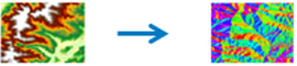
This tool creates an aspect map from an elevation data source. Aspect identifies the downslope direction of the maximum rate of change in value from each cell to its neighbors. Aspect can be thought of as the slope direction. The values of the output raster will be the compass direction of the aspect.
Bemeneti adatok
A magasságréteg, amelyhez az egyes cellahelyek kitettsége ki lesz számítva.
Eredmény réteg neve
The name of the layer that will be created in My Content and added to the map. Az alapértelmezett név az eszköz nevétől és a bemenő réteg nevétől függ. Ha a réteg már létezik, akkor a program megkéri, hogy adjon meg egy másik nevet.
Az Eredmény mentési helye legördülő mezőben megadhatja a Saját tartalom mappájának nevét, ahová az eszköz menti az eredményt.